Currently Outside:

60.5°F
Feels like:
58°F
---
|
High Today
61.2°F
12:00 AM |
Low Today
60.4°F
1:21 AM |
Yest High
61.8°F
11:13 PM |
Yest Low
45.7°F
4:41 AM |
Sta* High
85.0°F
2021 |
Sta* Low
34.9°F
2006 |
|
* This Station's Records Since 2009 |
|

|
Night time, Dry, Overcast
|

|
Wind:
N
18.3
Gusting to:
16.0 mph
|
 |
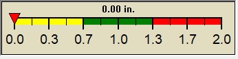
Rain:
0.00 in
|

|
Current CBI
Fire Danger:
100.0 of 100
|
|
|
| Current: |
-21.0°F
|
| Last Hour: |
0.3°F
|
| High 12:00 AM: |
-20.5°F
|
| Low 1:21 AM: |
-21.1°F
|
| Record High: |
83.3°F on
8/23/2023 |
| Record Low: |
-49.9°F on
3/23/2024 |
| Wetbulb: |
41.6°F
|
|
Rain Today
|
|
Today:
|
0.00 in
|
| Storm Rain: |
0.09 in
|
| Yesterday: |
0.09 in
|
| Last 7 Days: |
0.09 in
|
| Apr Rain: |
3.75 in
|
| Apr Avg: |
3.37 in
|
| Diff from Avg: |
 0.38 in 0.38 in
|
| Season:1 |
7.32 in
|
| Last YTD:1 |
6.87 in
|
Last Rain
Time/Date: |
4/26/2024
at 2:51 PM |
|
28 rain days in 2024 |
10 days in April
0 days since last rain |
|
| Current: |
N
18.3 mph
|
| 1Hr Average: |
16.5 mph
|
| Wind Run: |
28.33 miles
|
|
Wind Gust |
| Current: |
16.0 mph mph
|
| Today: |
27.0 mph 12:45 AM
|
| Month: |
46.0 mph
Apr-16 |
| Year: |
48.3 mph
Mar-3 |
| Record Gust: |
79.0 mph
3/3/2008 |
|
Sunlight:
13 hrs 53 min
of Sunlight Today
 57.8%
42.2%
57.8%
42.2%
Which is
2 min 30 sec Longer
Than Yesterday
|
|
|
Date must be before Mon, 13 Nov 2023 03:27:00 -0600 | |